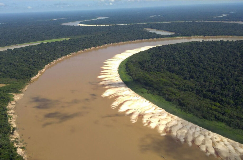
Monitoring of erosion and sedimentation in the Juruá River
The Juruá River, one of the most sinuous in the world, suffers from erosion and sedimentation along its banks, which can directly affect the lives of the populations living near it.
Using Landsat satellite images from 1984 to 2020 and cloud computing processing, ORBTY researchers, in partnership with the National Institute of Spatial Research (INPE), developed an algorithm that identifies the areas subject to these processes. It was found that 58.8% of communities live in stable areas, but 15.18% are exposed to erosion and 26.02% to sedimentation. Larger communities tend to be located in more stable areas, while smaller ones are more vulnerable to these processes.
The research shows how river dynamics can directly impact access to water, mobility and food security of these populations, and suggests the importance of including this knowledge in public policy planning to protect these communities and their livelihoods. It is worth noting that this research is the first to explore the relationship between the migration of meanders and riverside communities on the scale of the watershed, connecting local knowledge with environmental conservation.