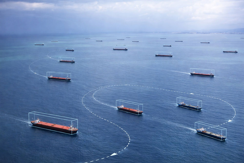
Combining data from multiple orbital sensors, our team developed the M3DFS – Multi-Dimensional Dynamic Data Fusion System, an exclusive framework that allows the generation of high-quality maps of meteorological and oceanographic parameters.
IDEAL FOR: oceanographic research institutions, port operators, companies in the maritime and coastal sector.
combined with advanced computer vision algorithms for automated vessel detection and oil spill identification. These techniques allow continuous and accurate monitoring of coastal zones and port areas, reducing operating costs and increasing responsiveness to environmental incidents and irregular activities.
Speed, wind direction and atmospheric water vapor, sea surface temperature, ocean color and speed of sea currents.
Support for near-real-time vessel tracking;
Historical analysis and forecast for specific operational issues, providing information for simple and impactful decision-making;
Planning for contingency and emergence of maritime operations.
Monitor with GEMAP (Geospatial Mapping of Aquatic Parameters)
Use our platform to transform orbital data into strategic decisions for your water management.
Try the GEMAP platform for 15 days at no cost.
Fill out the form and request access.
Monitoring with satellites from European and American stations;
Spatial resolution of 10 to 300 meters;
Weekly Monitoring.
Monitoring with commercial satellites;
Spatial resolution from 1 to 5 meters;
Monitoring that can reach the diary.