Each platform is customized according to customer demand,
Gathering interactive maps, dynamic graphics and automated reports. The system is compatible with multiple sources, including APIs, external databases and remote sensing products, ensuring continuous integration with existing workflows.
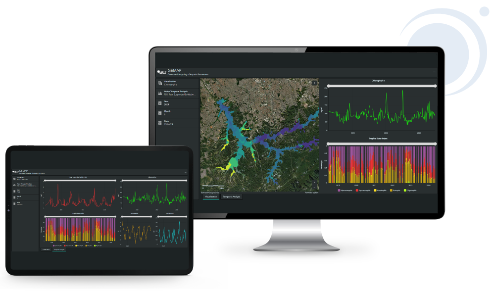
More than a monitoring tool, ORBTY platforms act as environmental intelligence centers, supporting strategic management, institutional transparency and technical communication between teams and partners. This translates into faster decisions, reduced operational costs and increased efficiency in continuous monitoring and territorial management projects.
Monitor:
Turbidity, Total Suspended Solids (TSS), Dissolved Organic Matter (CDOM), Secchi Disc, Trophic State, Temperature, Chlorophyll-a, Cyanobacterium and Phycocyanin, among other indicators.
Interactive panels with maps, graphics and historical series;
Comparative analysis and reporting tools;
Web access, with automatic updates and integration with APIs.